


Voting District 1396900000003, Ottawa County, Michigan
About
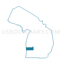
Outline

Summary
| Unique Area Identifier | 599268 |
| Name | Voting District 1396900000003 |
| County | Ottawa County |
| State | Michigan |
| Area (square miles) | 18.40 |
| Land Area (square miles) | 18.25 |
| Water Area (square miles) | 0.15 |
| % of Land Area | 99.20 |
| % of Water Area | 0.80 |
| Latitude of the Internal Point | 42.95757490 |
| Longtitude of the Internal Point | -86.09265560 |
Maps


Graphs
Select a template below for downloading or customizing gragh for Voting District 1396900000003, Ottawa County, Michigan


Neighbors
Neighoring Voting District (by Name) Neighboring Voting District on the Map
- Voting District 1390136000001, Ottawa County, MI
- Voting District 1390136000003, Ottawa County, MI
- Voting District 1390894000002, Ottawa County, MI
- Voting District 1393336000006, Ottawa County, MI
- Voting District 1396046000001, Ottawa County, MI
- Voting District 1396046000002, Ottawa County, MI
- Voting District 1396594000002, Ottawa County, MI
- Voting District 1396900000001, Ottawa County, MI
- Voting District 1396900000002, Ottawa County, MI
Top 10 Neighboring County Subdivision (by Population) Neighboring County Subdivision on the Map
- Allendale charter township, Ottawa County, MI (20,708)
- Grand Haven charter township, Ottawa County, MI (15,178)
- Robinson township, Ottawa County, MI (6,084)
- Blendon township, Ottawa County, MI (5,772)
- Olive township, Ottawa County, MI (4,735)
- Port Sheldon township, Ottawa County, MI (4,240)
Top 10 Neighboring Place (by Population) Neighboring Place on the Map
Top 10 Neighboring Unified School District (by Population) Neighboring Unified School District on the Map
- West Ottawa Public School District, MI (48,333)
- Grand Haven Area Public Schools, MI (39,731)
- Zeeland Public Schools, MI (30,843)
- Allendale Public School District, MI (20,707)
Top 10 Neighboring State Legislative District Lower Chamber (by Population) Neighboring State Legislative District Lower Chamber on the Map
Top 10 Neighboring State Legislative District Upper Chamber (by Population) Neighboring State Legislative District Upper Chamber on the Map
Top 10 Neighboring 111th Congressional District (by Population) Neighboring 111th Congressional District on the Map
Top 10 Neighboring Census Tract (by Population) Neighboring Census Tract on the Map
- Census Tract 244, Ottawa County, MI (8,294)
- Census Tract 213.04, Ottawa County, MI (5,016)
- Census Tract 220.01, Ottawa County, MI (4,818)
- Census Tract 219.01, Ottawa County, MI (4,120)
- Census Tract 243, Ottawa County, MI (4,092)
- Census Tract 213.03, Ottawa County, MI (2,726)